For Part 1 of the re-tracing of Major Mitchell’s 1836 expedition see my Pieces to Share blog posted January, 2023.
In the days when I studied Australian history the exploration of the continent was a major component of the curriculum………….along with Australia’s “discovery” (as though it had previously been lost!), the impact of the finding of gold, the inexorable spread of the land seekers and the squatters, the federation of the Australian colonies into the creation of the new nation. This schooling was in the 1950s, and the significance of the two world wars, of the economic depression of the 1930s, indeed the economic and social achievements of the 50 years of post-Federation nationhood, were still being digested. Moreover, the history of Australia before white settlement, and the contribution of the aboriginal races, was barely a blip on the radar.
Given the importance placed those sixty-plus years ago on the impact of the trail-blazing explorers in the early white history of the continent it’s somewhat axiomatic that Major Thomas Livingstone Mitchell does not today occupy a more significant place in the general imagination. Clearly it wasn’t always thus. Mitchell was a major figure in the early history of overland exploration, and was no doubt thought of as such in 1936 by the instigators of the memorial cairns. 1936 was the centenary year of Mitchell’s principal journey of exploration, the journey that was to become the inspiration for The Major Mitchell Trail volume.

The signposting of the Trail and, later, the preparation of theTrail book in 1990, are significant tributes to Mitchell’s achievements - although if the state of that signposting and the general accessibility of the Trail today is an indication, then Mitchell’s stocks these days are low indeed.
This instalment of my retracing (with son Dan) of Major Thomas Mitchell’s expedition across the region later to become the State of Victoria covers Mitchell’s traverse in a south-westerly direction from Mount Hope to Wando Bridge near the Casterton/Edenhope Road in the south-west of the State. It covers Mitchell’s journey from 29 June to 9 August 1836, and is described in maps numbered 6 to 12 in The Major Mitchell Trail volume.

The book indicates that along this stage of Mitchell’s journey there are some 18 commemorative cairns, erected in the centenary year 1936; and part of our objective in re-tracing the Trail was to locate and photograph these cairns.
The Trail - Maps 6 to 12 [days 26 to 67]
29 June to 9 August, 1836
Traversing Victoria from near Pyramid Hill, in a south-westerly direction past the Wimmera River to the area near the Glenelg River
We started this stage at Mount Hope, where we’d previously signed off, and did a bit of retracing. Presuming there was a walking track to the summit of Mount Hope we had intended to drive as far as possible, and then continue on foot. We did indeed drive as far as possible, but not to the end of the vehicular track – because we were blocked by a chained gate. Our disappointment at not being able to reach the summit (and to see the cairn) was somewhat assuaged by the blunt, but amusing, sign on the gate:
"WARNING
Mt Hope Run is Private Property
DO NOT ENTER
The Snakes, Goannas, Echidnas and Wallabies are trained to attack. Please leave alone unless you want to be videoed being bitten, spiked,
scratched or laughed at.”
We explored the lower slopes a little and, across the plain to the south we were able easily to see Pyramid Hill, and further away Mount Korong.
Major Mitchell camped nearby to Pyramid Hill on 29 June 1836, and on the 30th climbed to the summit.
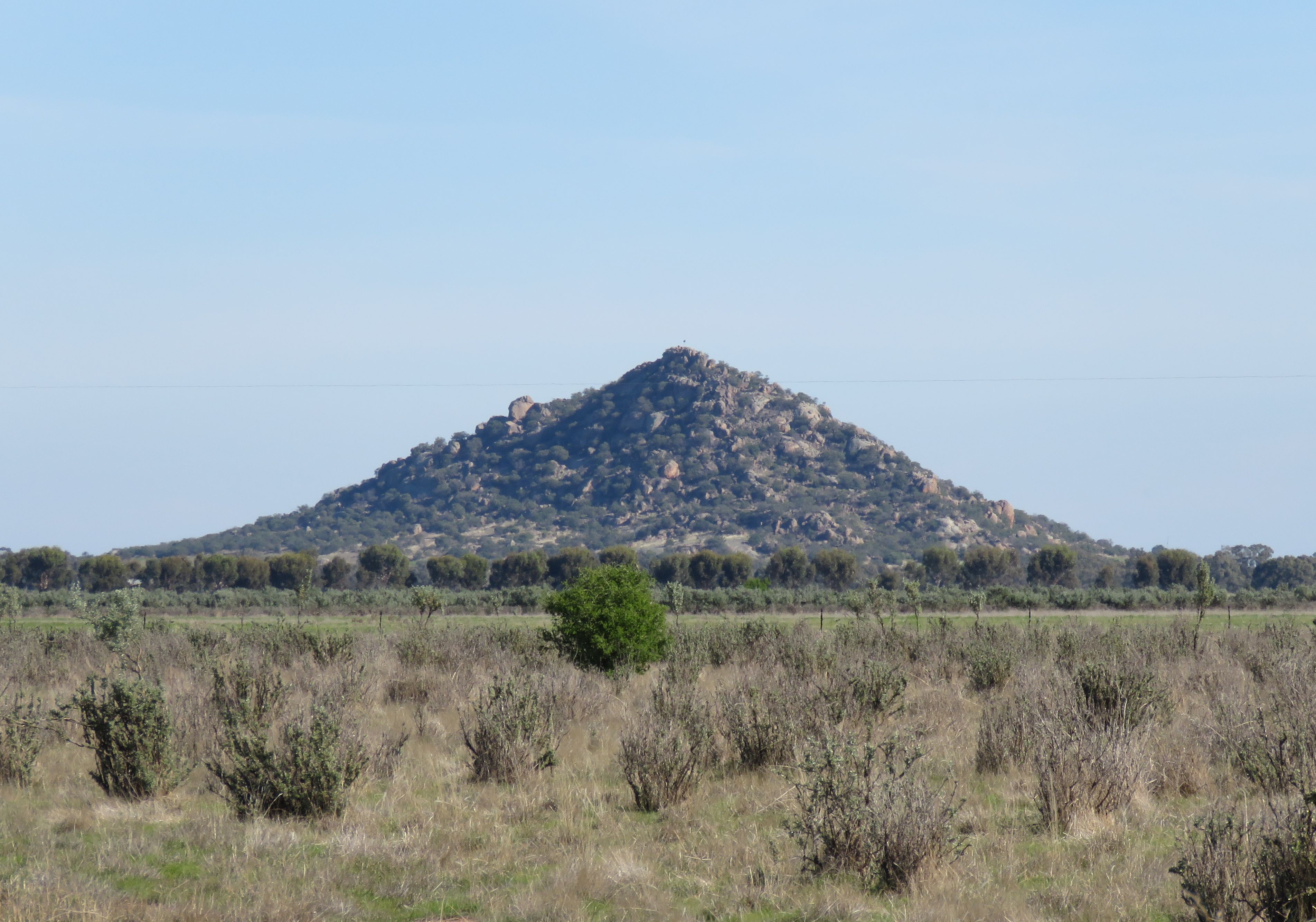
Mitchell the surveyor measured it as 295 feet above the surrounds. He lyrically describes the vista: “Its apex consisted of a single block of granite, and the view was exceedingly beautiful over the surrounding plains, shining fresh and green in the light of a fine morning. As I stood, the first European intruder on the sublime solitude of these verdant plains as yet untouched by flocks or herds, I felt conscious of being the harbinger of mighty changes; and that our steps would soon be followed by the men and the animals for which it seemed to have been prepared.”
What those men and animals have wrought over the succeeding years can be gauged from Mitchell’s description of crossing the Lodden River a couple of days later. The party had to construct a bridge to effect the crossing. Mitchell’s diary: “Late in the evening of this day (2 July 1836) we completed a bridge formed of short but strong sleepers laid diagonally to a fallen tree.” But by morning the party were amazed to find the bridge 1.2 metres under water, the Lodden having risen 4.3 metres overnight. There was no explanation for this phenomenon – there are no nearby snowfields, and it had not rained for five days. How long is it since the Lodden has flooded? How long since it was pristine? The “mighty changes” for which Mitchell described himself “harbinger” have occurred, although not all have accorded with his vision.
The boats were needed to assist with the crossing, which took all day. Mitchell’s diary throws an interesting spotlight on the logistics of the river crossing and, specifically, on the central role of the aboriginal guide, John Piper: “This was a very busy day for the whole party – black and white…….in tracing lost cattle, speaking to ‘the wild natives’, hunting, or diving. Piper was the most accomplished man in the camp. In person he was the tallest, and in authority he was allowed to consider himself almost next to me, the better to secure his best exertions……….The men he despised, and he would only act on my orders.”


There is also a commemorative cairn beside the Calder Highway to the south of Wedderburn, where Mitchell passed by on 7 July 1836,

and another beside the Bendigo/St. Arnaud Road near Kooreh. This flat-topped cairn was erected by local residents in 1955.

This place Mitchell describes as: “……one of the most beautiful spots I ever saw…….(with) the appearance of a well-kept park, that I felt loth to injure its surface by the passage of our cart wheels.”
I am mortified to report that, despite my earlier comment in Part 1 of this blog to the effect that Mitchell did not seek amity with the aboriginal peoples by proffering “beads and shiny tomahawks”, I find that on 8 July 1836 Michell gave an iron tomahawk to an old man in gratitude for describing the country ahead. That description: “Well watered and grassed, and with no barrier to reaching the coast.” But by this juncture Mitchell had become disinterested in heading for the coast – because on 10 July 1836 he had his first sighting of the Grampians; and on 11 July, away in the distance, he sighted, and named the Grampians peaks Mount Willian and Mount Zero.
Mitchell made camp beside the Richardson River on 12 July, using this site as a base for a three-day sidebar excursion to the Grampians, specifically to Mount William.
The next day Mitchell set out on horseback with six men, charging his second-in-command, Stapyleton, with the task of fording the expedition across the Richardson River. Mitchell described the grassy forest land they entered soon after as “one of the finest tracts they had ever seen”; but after crossing the Wimmera River (the name ascertained by Piper from the local aborigines) they found the country to be quite different – poor sandy soil, and stunted vegetation.
Leaving the horses grazing in the care of Piper, the party, with some difficulty, scaled Mount William on 14 July.

“The first part of our ascent, on foot, was extremely steep and laborious…….the upper precipice consisted of cliffs, about 140 feet in perpendicular height……Fortunately the ablest of the men with me was a house carpenter and, being accustomed to climb roofs, he managed to get up, and then assist the rest……Having gained the top…..we found winter and desolation under drizzling clouds.” The party spent a miserable night on the summit of Mount William. “We succeeded in keeping the fire alive, although while twigs were blown into red heat at one end, icicles remained at the other.” Two days later, after the Mount William party had returned to the Wimmera River, Stapylton recorded in his journal: “The Surveyor-General’s constitution must be as hard as iron, to stand three days of it without food, wet through the whole time, a bitter wind from the Southward on the summit chilling the frame violently heated with perspiration from the fatigue of the ascent……But he appears not at all the worse for it at present but positively in better health.”
Several days were spent in the shadow of the Grampians (which Mitchell named with due deference to the mountains in his native country), and in the vicinity of the nearby Wimmera River. “The richness of the soil, and the verdure near the river, as well as the natural beauty of the scenery, could scarcely be surpassed.”
Passing around the northern extremity of the Grampians, Mitchell made a diversion to the landmark Mount Zero on 20 July 1836.
From Mount Zero Mitchell observed that west of the Grampians it was comparatively low country, hopefully making it possible for him to reach the southern coast.
But, further again to the west, Mitchell had observed a striking outcrop, with “a most remarkable rock resembling a mitre” near to its base (Mitre Rock), and he resolved, “before turning southwards, to extend our journey to the isolated mass…..which I afterwards named Mount Arapiles”.
Returning to the main party, Mitchell passed Green Lake, and camped nearby.

The next night’s camp (21 July) was close to the Wimmera River. “Mitchell was anxious to learn where the Wimmera went beyond this point. Mount Arapiles was ahead and he wanted to know whether the stream flowed to the south or to the north of it……..Mitchell hoped he could follow the river south to the coast."
The 21 July 1836 campsite was not so far from present-day Natimuk. Today, in the centre of town, there’s a plaque on a large boulder noting that Major Mitchell passed close by on his way to Mount Arapiles.


The Wimmera River features for much of Mitchell’s journey over the next couple of weeks. Rather than running to the sea, Mitchell determined that the river flows generally north. His travels did not permit him to ascertain that the Wimmera disgorges into Lake Hindmarsh, then on via Outlet Creek to Lake Albacutya, thence with sporadic flow into Wyperfeld National Park and the rarely-filled Lake Brambruk. The most recent, and likely last, time Lake Brambruk received an inundation was in 1975 (before that 1910, 1917 and 1957). As a family the Andrews were able to camp at Wyperfeld in 1975, and to see the newly-flooded Lake Brambruk; and then again, in successive years, to observe the crop of burgeoning riparian River Red Gums that flourished as the flood waters slowly receded, never since to return.
From the summit of the Mount Arapiles massif Mitchell was able to look back to the Grampians, including Mount William some 86 km distant.
Further on, near Miga Lake,


Over the next twelve days the expedition travelled steadfastly south to south-east, although on the Trail map the route gives new meaning to the word meander.

Flat ground had to be found, although not so flat as to be swampy. And, then, the Glenelg River – which Mitchell initially named the Aboukir, after the Secretary of State for Colonies – had to be forded. The river was deep (3.5 metres) and full (35 metres wide), and the crossing by the expedition took the whole day of 31 July 1836. One bullock drowned.


On 4 August the expedition split into two groups. “The main party had to remain behind with the carts, having broken many of the chains and a shaft in their efforts to extricate the carts and the boat-carriage from the mud.” They rejoined the main camp the next day, and the day was spent on repairs and on building a bridge over the creek ahead.
After more days of generally adverse conditions (on 7 August they covered 1.5 kms only), the party was again surrounded by soft ground, and could “extricate themselves only by floundering through it. They had to take the loads out of the carts and carry them across by hand and then push the empty vehicles on to firmer ground”. Looking forward to better conditions the next day (9 August 1836), the members of the expedition were rewarded with nine kilometres of “green hills and running brooks”…….until they reached what is now known as Major Creek, “a ravine with such steep sides that it was extremely difficult to move the vehicles down”. The slope was tested with a light cart, but the incline was still too great. “The cart, together with the bullock pulling it, tipped over, depositing all Mitchell’s instruments under it in the bed of the stream.”
Camp was eventually established on the far bank…..and there we leave The Major Mitchell Trail, Part 2. Those so breathless with anticipation that they can't bear to wait for Part 3 will be happy to learn that Mitchell’s instruments were recovered intact, and that the bullock was unharmed.
To be continued………
Gary Andrews